
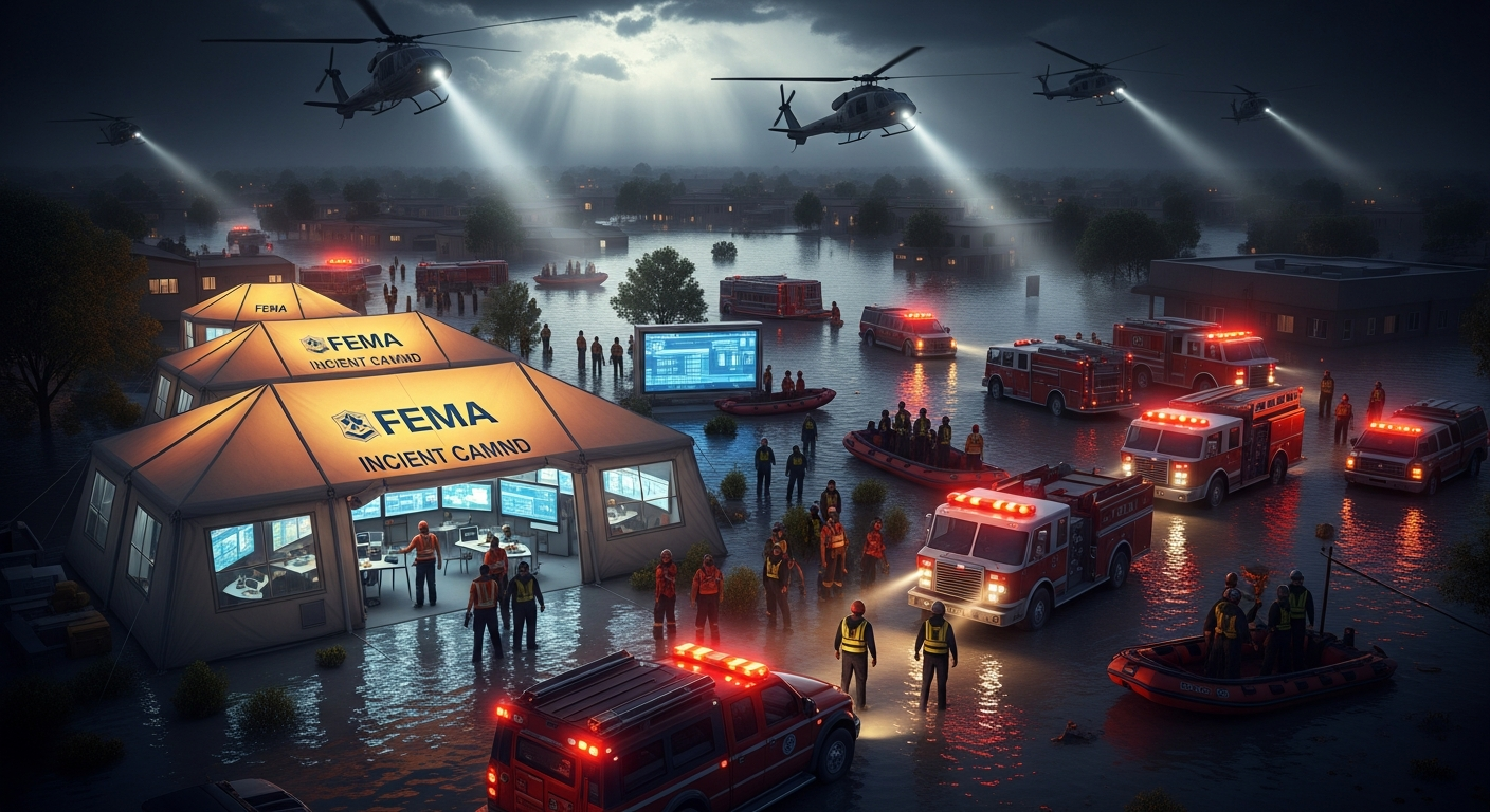
When the network goes down and the situation turns critical,
most C2 systems go silent.
Why Reconstruction Fails Under Degradation
When connectivity degrades, C2 systems stop recording. What happened between network partitions becomes impossible to reconstruct with authority. No system currently owns the originating record of a decision at the moment it was made.
Under DDIL conditions, each node maintains an independent picture. When connectivity restores, there is no authoritative record of which COP state drove which decision.
After-action reconstruction relies on operator memory and partial logs. The gap between what happened and what can be proven expands with every disconnected interval.
Without a custody chain, the decision timeline cannot be attributed with authority. Who knew what, when, under what information state — all contested post-event.
State reconciliation after partition is a manual, error-prone process. No existing C2 system defines the authoritative record that makes reconciliation deterministic.
ATLAS implements ODRA as a discrete architectural layer that existing C2 systems lack. Every command decision is captured as a cryptographically signed artifact at the moment of commitment — before network conditions change, before reconstruction is needed. FEMA Public Assistance reimbursement (44 CFR Part 206) requires contemporaneous decision documentation. Guard DSCA after-action reports require defensible decision chains (NGR 500-1). Congress mandated open, interoperable architecture for all federally-funded systems (10 U.S.C. § 4401). ODRA is the only system meeting all three of these existing federal obligations in denied or degraded conditions.
SHIELD | ATLAS is the open-architecture, multi-sensor C2 and C-UAS platform Army SBIR and C5ISR have been asking industry to build. Every Soldier is a Sensor™ delivers acoustic, RF, and radar fusion on commodity hardware at $93/node. No rip-out required — existing sensors connect through adapters, existing C2 systems receive fused outputs, nothing currently working stops working. Open platform, third-party extensible, integrated through nine adapters including CoT/TAK, AFATDS, and TITAN. DDIL-native by design. Built and running today by an SDVOSB-pending veteran-owned team.
Every branch. Every echelon. Every mission.
Army, Navy, Air Force, Marines, Coast Guard, SOF, FEMA, CBP, FBI, National Guard, state and local. From the private to the combatant commander — civilian and military on the same chassis.
You don’t need every tool — you need the right tool for your role
SHIELD/ATLAS is layered by echelon. Select your level below and the platform configures to match — same chassis, same data, right surface. See the full echelon model →
What changes when everything runs on one chassis
Two products. One chassis. Built to serve both sides of the mission.
SHIELD protects the individual. ATLAS commands the operation. Same codebase, same training, same investment — civilian emergency management and military C2 on a single platform that serves both customer bases without compromise.
SHIELD
An installable safety app that runs in any browser. No app store required. Uses your device's own sensors to protect you in real time.
- Hidden tracker detection (AirTags, Tile, BLE)
- SafeWalk with GPS + fall detection
- Panic button with auto 911 + GPS sharing
- SmokeGuard fire alarm listener
- Community threat alerts
- Works offline with no account
ATLAS
Dual-use custody layer serving military, FEMA, FBI, CBP, and state/local from a single codebase. Every decision issued inside ATLAS is signed, chained, and verifiable under degraded conditions — the same ODRA layer regardless of domain. OGC WMS/WFS/WMTS geospatial services, ISO 19115 metadata catalog, MIL-STD-2525D symbology, ODIN AI decision support, and Every Soldier is a Sensor™ C-UAS. DDIL-capable. Zero-trust. No installation required.
- Full-spectrum custody: GEOINT, C2, Fires, Protection, Sustainment, EM, Training — every decision signed and verifiable
- OGC WMS/WFS/WMTS + ISO 19115 + MIL-STD-2525D symbology
- Every Soldier is a Sensor™ C-UAS ($30/node counter-drone)
- 9 adapters: DCGS-MC, NGA, CoT/TAK, STIX/TAXII, TITAN, AFATDS
- 21 training courses, 20 certifications, help desk with SLA tracking
- Offline-first PWA. AI fires engine. OPSCENTER full C2. Zero-trust.
Every sensor feeds one shared picture — with full accountability built in
USEIF ingests existing sensor architectures across land, sea, air, space, cyber, and spectrum domains, scores them by multi-engine AI consensus, applies AGOS rule-of-engagement gating with full audit chain, and republishes the result into the COP as enriched analytic services. The commander acts on a single auditable picture in seconds, not staff hours. The platform augments existing sensor investment rather than replacing it.
Real-Time Cross-Domain Communication
Every connected unit shares information continuously. A ground sensor detects movement — aerial assets see it instantly. A maritime radar tracks a vessel — shore-based operators have the picture immediately. No phone calls. No radio relay. No waiting. The platform handles the translation between protocols automatically.
Collaborate Across Organizations
Military units coordinate with FEMA. Local fire departments share data with state emergency management. Border patrol sensors feed the same picture as CBP air assets. Different organizations, different missions — one shared understanding of the operating environment.
Protocol Translation Built In
CoT/TAK, Link 16, VMF, STIX/TAXII, CAP/EDXL, OGC, MQTT, BACnet, Modbus, ASTERIX, AIS, ADS-B. The platform speaks every protocol so your people don't have to. Plug in a sensor, it joins the network.
Radar, EO/IR, SIGINT, acoustic, seismic, chemical, radiation, weather, UAS, maritime AIS, and more
Kinetic, electronic warfare, directed energy, cyber, CBRN, law enforcement, and first responder
CoT/TAK, Link 16, VMF, STIX/TAXII, OGC, MQTT, AIS, ADS-B, CAP/EDXL, and more
Land, sea, air, space, cyber, and electromagnetic spectrum — all fused into one picture
The Universal Listener — Nothing Touches Your Equipment
Every military sensor already broadcasts its data onto a tactical network. SHIELD/ATLAS connects to that network and reads what every system is already saying. Then it translates into whatever format every other system needs. Zero modifications to your equipment. Zero impact on operations.
Patriot, Q-53, AEGIS, THAAD, Sentinel — already broadcasting on Link 16, FAAD C2, IBCS, or CEC. We place a device on that same network. We listen. We translate. Your equipment runs exactly as it does today. Your operators won't even know we're there.
Standalone sensors and legacy systems with serial or Ethernet outputs. One read-only cable from your system's existing data port. Your system runs unchanged. We read what it already outputs.
Infantry, convoys, FOBs with no radar. Plug a $48 SDR and $30 microphone into any phone or tablet. ESMS creates C-UAS, C-RAM, and GPS-denied capability where none existed. $93 per node.
Works when the network goes down. Speaks every standard. Connects to what you already have.
Every module operates in denied, disrupted, intermittent, and limited environments. Open standards across the surface — OGC WMS/WFS/WMTS, MIL-STD-2525D APP-6D symbology, ATAK Cursor-on-Target, STANAG. Configuration determines whether the surface drives a brigade TOC, a maritime interdiction cell, a counter-drone team, or a county EOC. Same chassis, every echelon, L0 through L4.
Every Soldier is a Sensor™ C-UAS + C-RAM + GPS-Denied PNT
One $150 sensor mesh delivers three mission capabilities. Counter-UAS: detect, classify, and track drones. Counter-indirect fire (C-RAM): detect mortar/rocket/artillery launches, triangulate the firing position, and auto-generate counter-battery fire missions in under 4 seconds. GPS-denied navigation: 6 independent backup positioning methods. Three problems. One investment. No additional hardware between missions. Full battalion: $49K vs $15M+ for legacy C-UAS alone.
OPSCENTER — Full Military C2
TLP/MDMP, OPORD/WARNO/FRAGO wizard, Sync Matrix, DSM, Running Estimates, 11 tactical reports, Battle Rhythm, ROE, CAS 9-LINE, Unified COP.
FIRES — AI Ballistic Engine
15 munition profiles. VTC live camera fire control. CDE/NSL compliance. Export to TITAN, AFATDS, CoT, VMF. BDA visual assessment. Eyes on target.
GEOINT Services (OGC/ISO)
OGC WMS 1.3.0, WFS 2.0.0, WMTS 1.0.0. ISO 19115 metadata catalog. MIL-STD-2525D symbology (APP-6D 20-char SIDC). 10-format download manager. 8 GEOINT product templates.
ODIN — AI Decision Support
COA generation with risk scoring. Auto-SITREP. Predictive threat analysis. Zero-hallucination SOP (10 rules). Targeting intelligence. Logistics optimization.
9 Integration Adapters
DCGS-MC, NGA, TalonNET, AFATDS, TITAN, CoT/TAK, STIX/TAXII, MCISRE, Cross-Domain Solution (CDS). Plug-and-play interop. MOSA-compliant.
PATHFINDER — GPS-Denied Navigation
6 backup positioning systems: RF mesh triangulation (your SDR dongles become the nav system), landmark triangulation, dead reckoning, celestial navigation (57-star USNO catalog), eLoran, LEO PNT. Weighted fusion of all available sources. 9 adversary GPS jammer profiles recognized (R-330Zh, Pole-21, Krasukha-4). Auto-switches to backup before operators notice jamming.
Universal Listener — Zero Impact on Your Systems
Passively connects to existing tactical networks and reads what 14+ military systems are already broadcasting. Translates to 5 formats simultaneously. No modification to existing systems. No software uploads. No cables to your equipment. Your operators won't even know it's there. Works the same way whether you have a billion-dollar radar or no sensors at all.
The Convoy Scenario — Every Soldier Is A Sensor™
10 vehicles, 30-mile route. Every other vehicle carries a tablet, USB-C hub, $48 SDR dongle, and $30 microphone. Five sensor vehicles create the hardware floor for overlapping C-UAS + C-RAM + GPS-denied coverage along the route. The same mesh that detects enemy drones also detects mortar and rocket launches and triangulates the firing position; the resulting track is queued as a mission proposal for human commander review. ATLAS does not author ballistic numbers or auto-release fires — ROE-required human-in-loop is hard-coded. Multi-node handoff/overlap logic is on the WS-2 backlog (today: single-node detection works; mesh sync is in progress). Total hardware: $2,215.
Live endpoints below. Click any panel for the raw API response.
The data in each panel is generated by the SHIELD/ATLAS engine in real time against production routes. No screenshots, no slides, no static fixtures. Every panel is independently curl-able from the API index.
C-RAM Kill Chain — Live
Acoustic Signature Library — Live
IDF Weapon Profiles — Live
System Status — Live
All panels above fetch from live API endpoints on this server. No cached data. No screenshots. Evaluators: inspect network tab to verify.
Doctrine-grounded recommendation generation captured within the authoritative decision state vector
AI in ATLAS is not a situational awareness layer. It is a recommendation engine whose outputs are captured as part of the decision state vector at the moment of commitment. Every COA, every assessment, every predictive output enters the ODRA custody chain — not a separate AI log.
OGC Geospatial Services
WMS 1.3.0, WFS 2.0.0, WMTS 1.0.0 with 12 operational layers. ISO 19115 metadata catalog with 42 curated datasets. Standards-based data serving for any GIS client.
MIL-STD-2525D Symbology
APP-6D 20-character SIDC decode. Symbol lookup by name, affiliation, or dimension. 600+ symbols. Renders standard military map graphics across all modules.
Training & Certification
21 courses, 162 hours, all operational domains covered, 20 certification paths, 21 sandbox scenarios. Same platform for training and operations — decisions in training carry the same ODRA signature as decisions in ops. No separate training system.
ODIN AI + Zero-Hallucination SOP
COA generation, predictive threat analysis, auto-SITREP, BDA assessment. 10 rules governing all AI outputs: never fabricate data, declare uncertainty, cite sources, targeting-safe.
11 Cross-Module Event Bridges
C-UAS detection triggers FIRES targeting. Weather alerts update OPSCENTER CCIRs. Earthquake data activates EMS triage. Sustainment shortfalls update combat power. Automated, real-time.
Help Desk & Support
Tier 1/2/3 support with SLA tracking. Critical: 15 min response, 4 hr resolution. Knowledge base with 11 categories. 24/7 for Critical/High priority incidents.
Working code or it does not exist — every claim maps to a live endpoint
Each module below is a production decision-support tool wired to real data sources, with human-in-the-loop approval at every critical step. Every advertised capability is auditable to a live API route via the /api-index catalog and is scanned on every commit by the capability-claim audit gate.
Common Operating Picture
Live COP with AIS vessel tracking, METOC weather overlay (Open-Meteo), terrain analysis (Copernicus DEM), MIL-STD-2525D symbology, and force tracking. Real-time tactical awareness.
DIME/PMESII-PT Analyzer
6-step planning wizard pulls live weather & terrain, generates DIME COAs with tradeoffs, CARVER targeting, effects tracking (MOE/MOP), and D3A/F3EAD cycle integration. Commander approves before execution.
SIGINT Operations Center
5-step intercept wizard with COMINT/ELINT/FISINT/MASINT classification, frequency analysis, pattern matching against known emitters, automated threat assessment with analyst override, and emitter tracking.
Cyber Operations Center
FPCON auto-assessment (NORMAL through DELTA), 5-step incident wizard with containment guides, threat actor reference (APT28/29/41, Lazarus, Sandworm), response playbooks, and automated posture updates.
Logistics & Supply Chain (S4/G4)
10 classes of supply readiness dashboard, inventory management, 4-step supply planning wizard that identifies critical shortages, auto-calculates priorities, and generates resupply requests. Commander approves before submission.
METOC & Terrain Analysis
Live worldwide weather from Open-Meteo with tactical impact assessment (GND/AIR/NAV/ISR/COMMS). Copernicus DEM GLO-90 terrain with slope, aspect, mobility analysis, and intervisibility for any coordinate on Earth.
Joint Decision Support (JOC)
Cross-domain situation aggregation, correlation detection, 1st/2nd/3rd order effects modeling, and synchronized decision-making. Pulls live data from SIGINT, Cyber, Logistics, DIME, and METOC. Models cascading effects before you act.
What works offline. What goes dark. Honest by design.
Disconnected is the default operating condition, not a fallback. Every module below is tested against a six-hour offline window before it ships. Read what works without a data connection — and what requires one.
| Capability | DDIL / Offline | Requires connectivity for |
|---|---|---|
| Common Operating Picture (COP) | FULL | Live feed updates (FIRMS, ADS-B, AIS) |
| AGOS audit chain / kill-chain workflow | FULL | Chain sync to remote replica on reconnect |
| ODRA — Decision state artifact capture + custody chain | FULL | Custody chain replication to secondary nodes on reconnect |
| C-UAS / ATLAS Beacon detection | FULL | Signature library updates |
| ODIN AI reasoning / doctrine analysis | PARTIAL | LLM inference (cached corpus available offline) |
| Logistics / 10 classes of supply | FULL | CRDT sync on reconnect (zero data loss) |
| WARFIGHTER / COA generation | PARTIAL | Real-time weather/terrain data pulls |
| ICS/NIMS / CAP authoring | FULL | IPAWS submission (requires IPAWS account) |
| Training (21 courses / 162 hrs) | FULL | Certificate issuance sync |
| Mass notification | REQUIRES | Connectivity required — notification delivery is the service |
One platform. Six types of operators. No separate tools, no separate training.
One custody layer. Six operator domains. Configuration determines the mission surface — military staff, fire chief, FBI analyst, border protection, city manager are all generating decisions inside the same ODRA infrastructure. The signed artifact chain does not change. The verification endpoint does not change. The reconstruction capability does not change.
Every Soldier is a Sensor™ C-UAS works for military counter-drone AND civilian airport/stadium/border protection. OGC geospatial services work for NGA AND state emergency management. The same training courses serve all users. One investment, six revenue streams.
Defense & Military C2
Every Soldier is a Sensor C-UAS staging, OPSCENTER (TLP/MDMP) decision-support, ODIN AI document workflows, integration adapters, GEOINT products, OGC services, BFT/CoT NATO export. AI is decision-support only — it does not author ballistic numbers; lethal effects require human-in-loop.
Emergency Management
ICS/NIMS, FEMA PA/IA, disaster declaration workflow, ESF activation, EMAC mutual aid, mass casualty triage, CAP/IPAWS alerts
Critical Infrastructure
Pipeline/rail/coastal/airfield protection, cascading failure analysis, SCADA monitoring, climate adaptation, wildfire detection
Personal Safety
Tracker detection, SafeWalk GPS, panic button, AI safety autopilot, reunification, community threat alerts
28 Live Federal & Open-Source Data Feeds
Every feed below is a real, named endpoint the platform queries on a live cadence. Click any provider to view its source URL.
28+ live federal & open-source endpoints. No fake data. No simulations. All real. All now. Pull cadence: 30s – 24h depending on source. Cached server-side; never resold.
Integrated Services and Solutions LLC (ISS) — Service-Disabled Veteran-Owned Small Business — Dr. Terry Flood
Proof endpoints: /api/health/live · /api/evaluator/capabilities · /dod-cop · /governance · /evaluate
What This Page Is
What To Do First
Use My Location?
This page works best with your current GPS location.